


- Sku: PCIV4258S
- Barcode:
- Type: Vintage Maps
Cities Service Gas Station New Jersey Highway Map 1964
We ship to all 50 US states, Puerto Rico, APO addresses, US territories, Canada, Australia, and New Zealand
1964 New Jersey Highway Map from the gas station operator Cities Service. The map folds out to a size of approximately 30" x 18".
1964 was the last year the company issued maps with the "Cities Service" name before changing their corporate name to "Citgo" in 1965.
Side 1 of the map includes a map of the state of New Jersey, small city maps of Atlantic City and Trenton, a list of counties, and a list of NJ cities with 1960 census figures.
Side 2 of the map has a large map of the Newark/New York City area and shows the location of the 1964-1965 New York World's Fair, and there is also a map of the Philadelphia metro area.
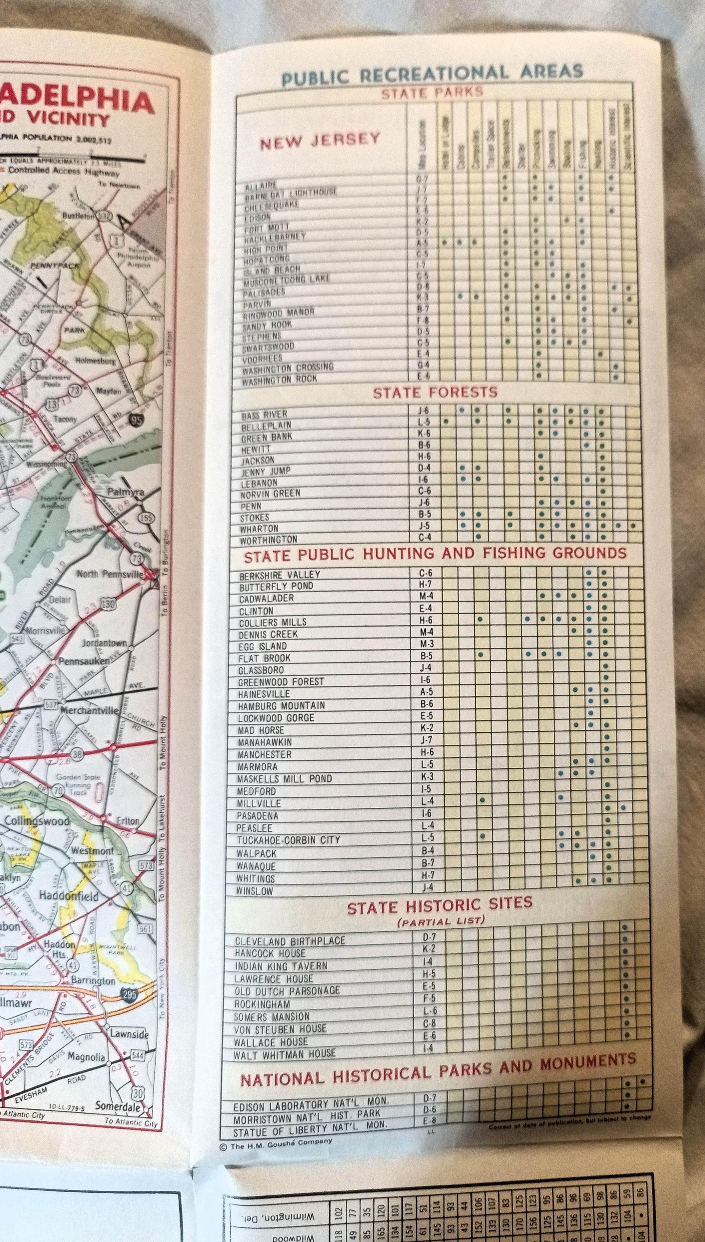
Side 2 also has indexes showing airports and seaplane bases, yacht and boat clubs, golf and country clubs, and points of interest, and a mileage chart. There is a table showing public recreation areas (state parks, forests, state hunting and fishing grounds, historic sites) and the amenities available at each of them.
The map is in excellent condition.
Have a question?


Cities Service Gas Station New Jersey Highway Map 1964


