


- Sku: PMIV0584S
- Barcode:
- Type: Vintage Maps
Michigan 1968 Official State Highway Department Road Map
We ship to all 50 US states, Puerto Rico, APO addresses, US territories, Canada, Australia, and New Zealand
1968 Michigan Official State Highway Map issued by the State Highway Commission in Lansing.
Side 1 of the map includes a state highway map of Michigan, a mileage chart, an index of cities and villages, an index of counties and county seats, a listing of Michigan State Police posts, toll bridge and tunnel rates for the Mackinac Bridge, International Bridge, Ambassador Bridge, Windsor Tunnel, and Blue Water Bridge.
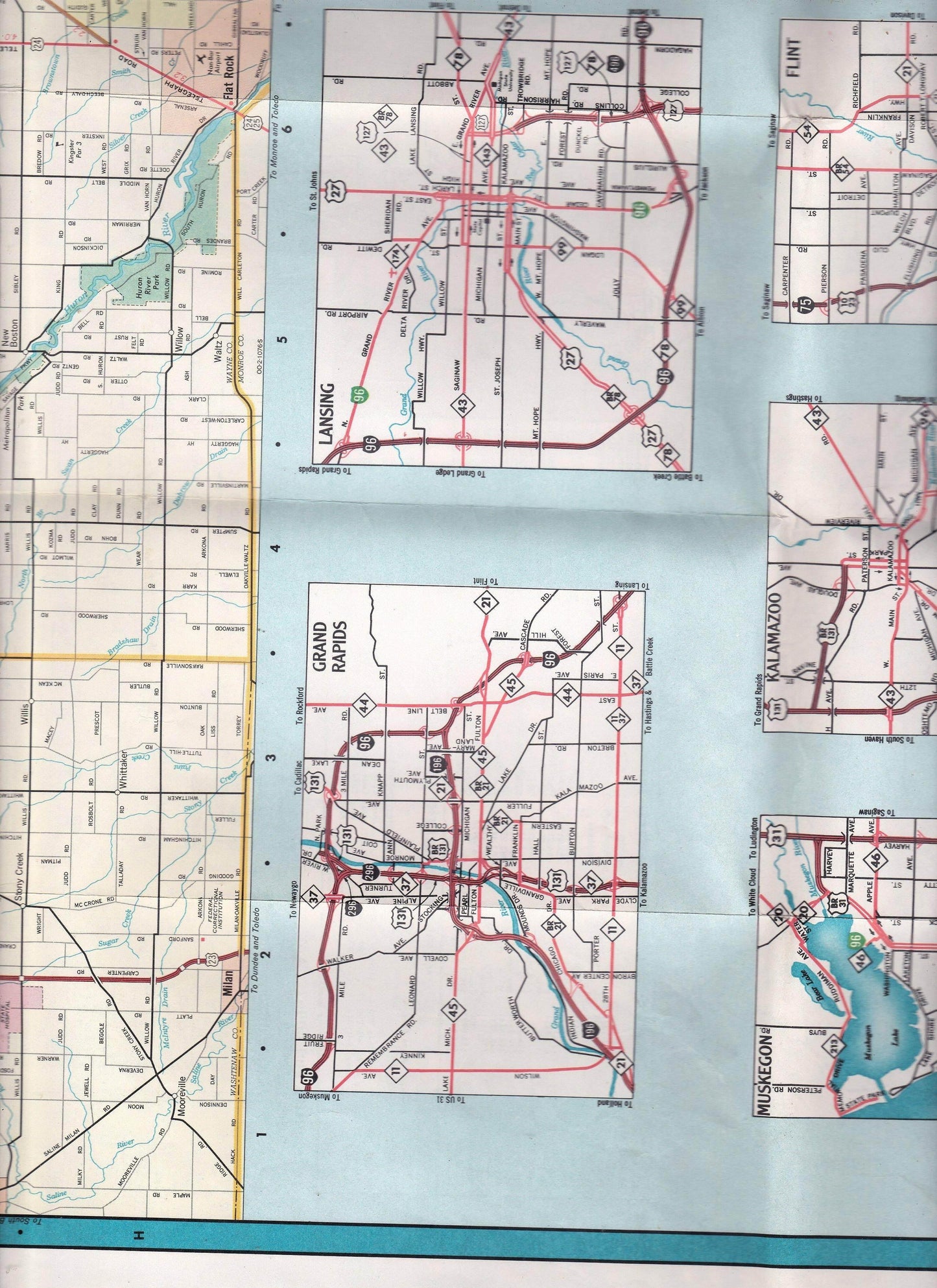
Side 2 has a large map of metro Detroit, and smaller maps of Grand Rapids, Lansing, Flint, Bay City, Midland, Kalamazoo, Muskegon, Benton Harbor, Jackson, Battle Creek, and Saginaw. It also has a table listing Michigan State Parks and their amenities.
Folds out to a large size of approximately 28" x 28".
The map has a small 1/2" circular stain near the middle of the bottom (see photo 1) but is otherwise in very good condition.
Have a question?


Michigan 1968 Official State Highway Department Road Map


