


- Sku: PNEV5106S
- Barcode:
- Type: Vintage Maps
New Jersey Turnpike Gateway To America Map Brochure 1964
We ship to all 50 US states, Puerto Rico, APO addresses, US territories, Canada, Australia, and New Zealand
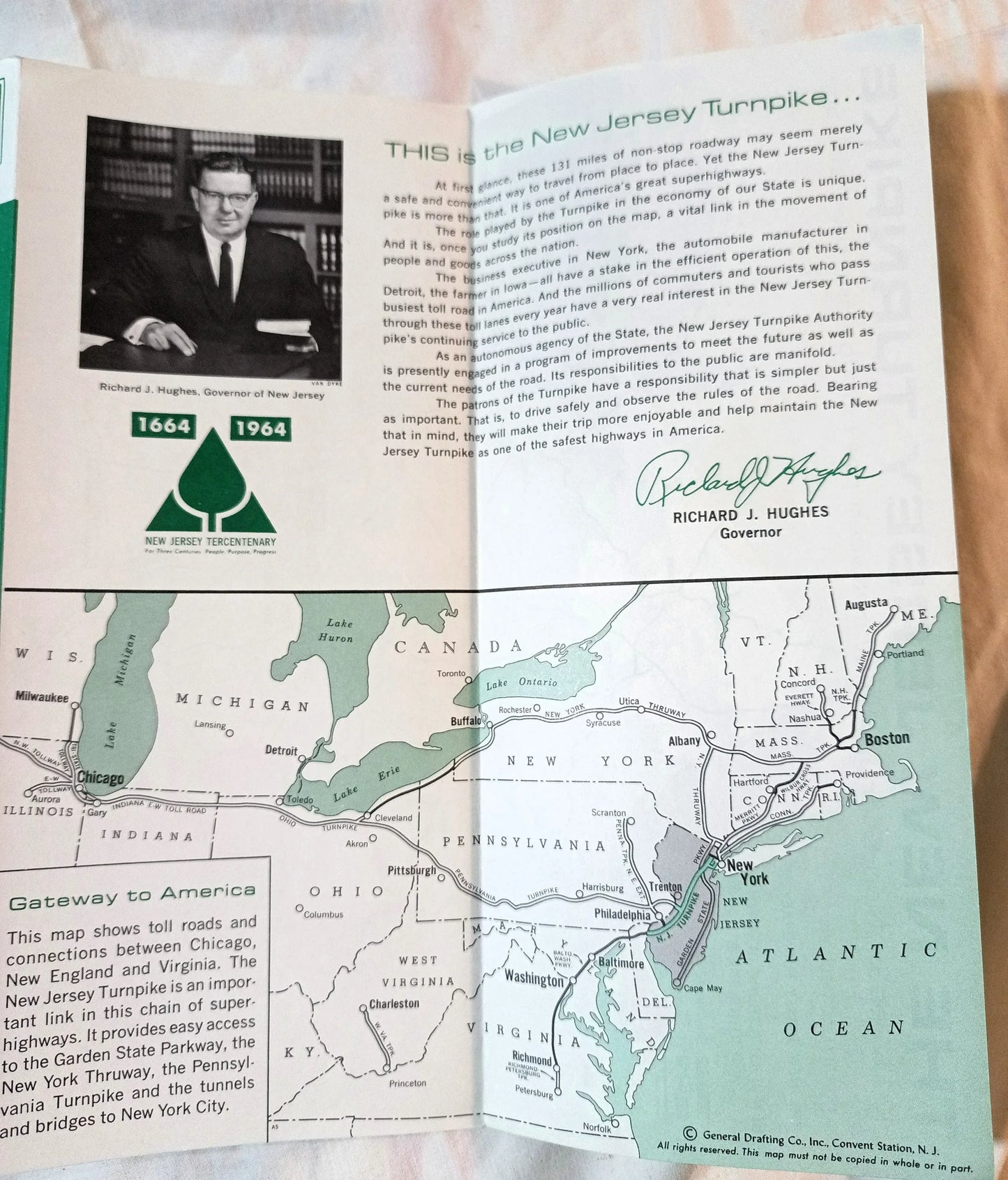
1964 New Jersey Turnpike map and brochure issued by the New Jersey Turnpike Authority. The governor at the time was Richard J. Hughes, and New Jersey was celebrating its Tercentenary (1663-1964).
Side 1 folds out to a map showing the major interchanges on the 131 mile long turnpike, and there is a smaller inset map showing the turnpike's exits in the New York City area. There is also a table showing the toll amount between various entry and exit points.
Side 2 has an introduction by New Jersey's Governor Hughes, a small "Gateway to America" map that shows the major toll roads and connections between Chicago, New England, and Virginia and how the NJ Turnpike hooks into them. The back panel has safety tips.
The 4-panel 2-sided brochure folds out to a size of approximately 9.5" x 16.5".
The brochure is in excellent condition.
Have a question?


New Jersey Turnpike Gateway To America Map Brochure 1964


