


- Sku: PVIV4226S
- Barcode:
- Type: Vintage Maps
Virginia Official State Highway Map Dept Of Highways 1966
We ship to all 50 US states, Puerto Rico, APO addresses, US territories, Canada, Australia, and New Zealand
1966 Virginia Official State Highway Map issued by the Commonwealth of Virginia Department of Highways. The governor at the time was Mills E. Godwin Jr.
Side 1 of the map includes a state highway map of Virginia, and small city maps of the Washington D.C. area, Richmond area, Roanoke area, Hampton Roads area, Lynchburg area, Petersburg area, and Colonial National Historical Park. There is also a mileage map, and an index of cities, towns, and communities,plus a chart showing Virginia's population from 1900 to 1965..
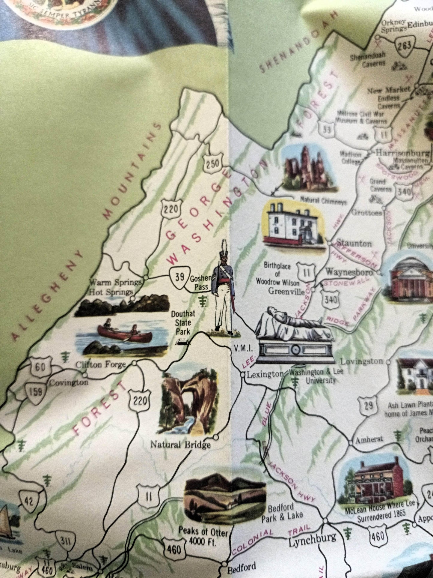
Side 2 has photos and a map showing "some of the Old Dominion's better known historic shrines, scenic attractions, and natural wonders". The map also has a listing of "waysides for parking and picnicking", state police contact info, info on speed limits and reporting traffic accidents, and an illustration showing Virginia pavement markings.
The map folds out to a size of approximately 37.5" x 25.5".
The map is in excellent condition.
Have a question?


Virginia Official State Highway Map Dept Of Highways 1966


